THE ROAD TO GOLD AND KALGOORLIE

UNADJUSTEDNONRAW_thumb_768.jpg

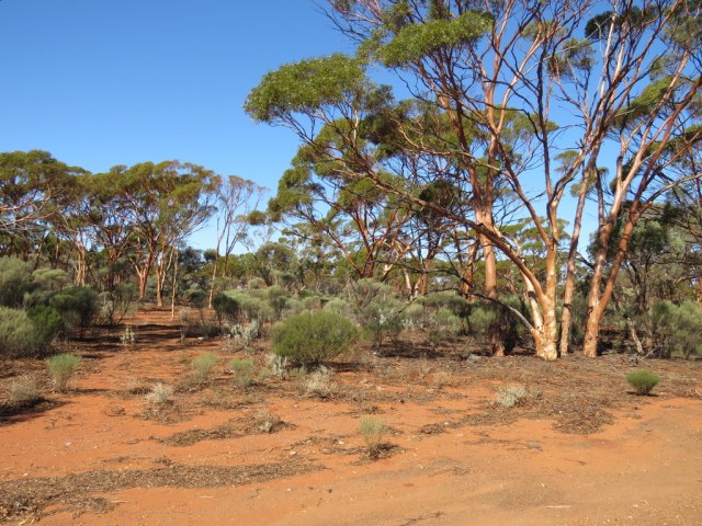
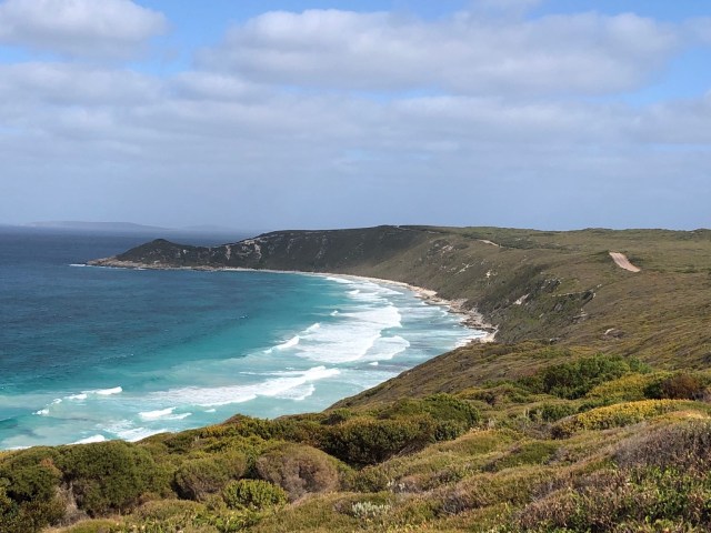
Beautiful Salmon gums lined much of the road north from Esperance to the Gold city of Kalgoorlie. Located in the Eastern Goldfields area, Kalgoorlie/Boulder is Australia’s largest Outback city and one of the oldest – and many beautiful old buildings remain as a link to the past.  We had heard a lot about this city and the mines and the first sight we came across was the Super Pit Lookout.

UNADJUSTEDNONRAW_thumb_84c.jpg

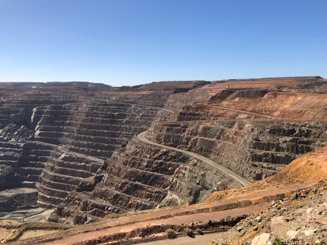
Here we could see a working mine in action and watched a blast.  This pit is 3.7km long and 1.5 km wide and 600 metres deep.  It is quite incredible to watch the workings and see the trucks weaving their way up and down- like little ants in a hole.

UNADJUSTEDNONRAW_thumb_84d.jpg

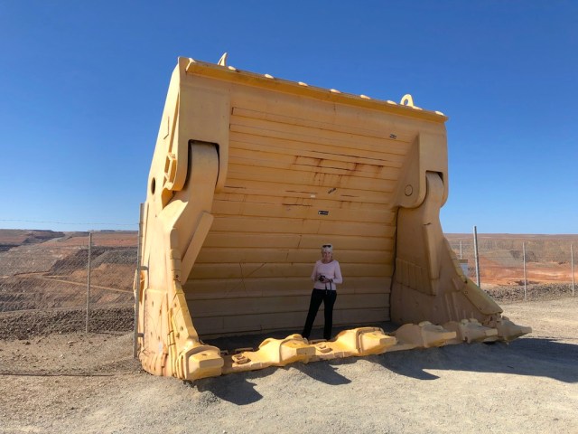
A shovel of a 994F loader is here for visitors to step into showing the sheer size of the machine.

IMG_4218

The tyres are bigger than a man and the vehicle itself is a monster!

UNADJUSTEDNONRAW_thumb_84f

UNADJUSTEDNONRAW_thumb_850

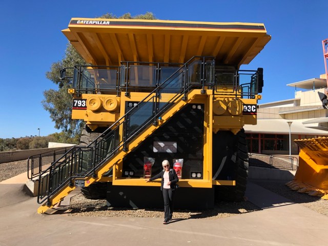
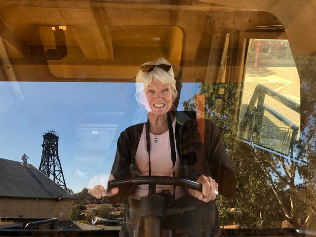
Later, at Hannans North Tourist Mine we had the opportunity to climb inside and then fully appreciated what the drivers of these machines have to do day in and day out. This mine gives visitors the opportunity to experience gold rush history  and modern day mining. Wandering through the re-created part of the mining camp, I really felt for the Pioneers and gold seekers in the heady gold rush days.  Living in tents and huts of corrugated iron in the dry, hot and dusty town must have been hard but all were hit with “gold fever” and were sure they would find their fortunes here.

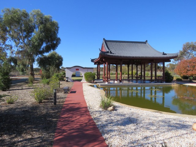
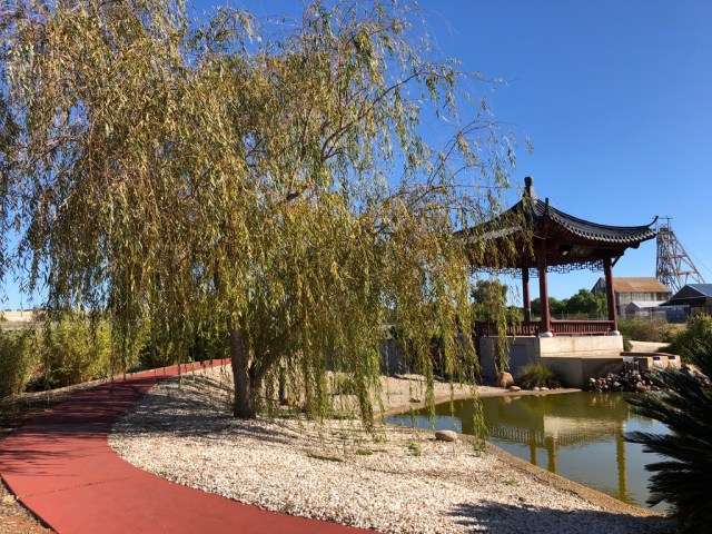
In a tribute to the Chinese who flocked here in large numbers and contributed to the community in many ways, the city has built a beautiful Chinese garden.  Wandering through with soft Chinese music playing in the pavilion by the lake, it was easy to see how some of these people would have been very homesick and missed their country.

UNADJUSTEDNONRAW_thumb_75c.jpg


UNADJUSTEDNONRAW_thumb_853.jpg

UNADJUSTEDNONRAW_thumb_856.jpg

One attraction in Kalgoorlie that links to the heady gold rush days is “Questa Casa” which is Australia’s Oldest Brothel  it has been in operation for 115 years and is possibly the world’s oldest working brothel. There are countless stories and books about how it was in “old” Kalgoorlie for these ladies of the night and the lonely miners who visited them.

UNADJUSTEDNONRAW_thumb_7a3.jpg

This brothel has the famous “Starting Stalls” which are still operating and the girls throw open the doors nightly. Tours are available daily – sadly we didn’t have time to do one!

We wandered through the wide streets of the city and marvelled at the beautiful historic buildings – many of which have been restored and are now shops and businesses.  With the golden light of late afternoon, this was a perfect time to appreciate the architecture and imagine the city at the turn of the century and earlier.

UNADJUSTEDNONRAW_thumb_79a.jpg

UNADJUSTEDNONRAW_thumb_79d.jpg

UNADJUSTEDNONRAW_thumb_798.jpg

UNADJUSTEDNONRAW_thumb_7a2

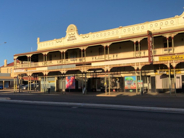
Even the interior of some buildings has retained its past glory – as we saw when we had breakfast the following day before hitting the road across the Nullarbor.

GZOaTrNqQUaDf15FrtD3nA_thumb_7a1.jpg


THE OPEN ROAD TO ESPERANCE

IMG_3680.JPG

Esperance is located on the pristine Southern Ocean coastline and is often described as “out of the way” but it is well worth the effort to get there.  It is surrounded by National Parks and many really beautiful beaches of pure white sand and crystal clear water in the most vibrant of turquoise hues.

We stayed in town where the foreshore meets the CBD and it is easy to walk to the many restaurants, shops and artisan galleries.  The iconic sculpture of a whale tail is surely the most impressive along this stretch of coastline.

UNADJUSTEDNONRAW_thumb_727.jpg

Just around the corner is the historic centre where old houses have been converted into galleries and gift shops and it is a really lovely place to wander and perhaps purchase an unusual gift to take home. What a great use for these historic buildings – keeping stories of the past alive.

The Great Ocean Drive is purported to be one of the most beautiful drives in Australia and it seemed that at every bend there was jaw dropping scenery.  Towering cliffs, rugged bush, red rocks dropping into powdery white sand really does present an artists’ palette and even the most sceptic would agree that this is quite incredible.

UNADJUSTEDNONRAW_thumb_82d.jpg

UNADJUSTEDNONRAW_thumb_82e.jpgUNADJUSTEDNONRAW_thumb_82c.jpg

Twilight beach is one of the most photographed in the area but each beach had its own special brand of beauty.

UNADJUSTEDNONRAW_thumb_833.jpg

UNADJUSTEDNONRAW_thumb_834.jpg


UNADJUSTEDNONRAW_thumb_839.jpg

Many of the beaches had access via wooden walkways and stairs and safe swimming from either the flat rocks or the sandy beach is possible.

Beyond is the Recherche Archipelago with more than 110 islands offering perfect spots for diving, swimming, snorkelling and fishing.

Then, wearied by all this scenic beauty but not to be outdone, we drove out to Cape Le Grand National Park where we had been told of more jaw dropping scenery.  This is possibly the most spectacular of the Southern Coastal National Parks and is about half an hour east of Esperance. The park’s rolling heathlands are home to pygmy possums and western grey kangaroos – and these can often be seen lounging on the white sandy beaches or skipping through the campsites and carparks and socialising with visitors.

iUuIAy0ET5yV3wY556CVAw_thumb_736.jpg

We gasped when we saw Lucky Bay – it is honestly the most beautiful beach I have seen so far.

gQbGLe79SpeU%NE5kjmN1A_thumb_74a.jpg

UNADJUSTEDNONRAW_thumb_841.jpg

Nearby is “Whistling Rock” so named because the wind whistles through the gaps and makes quite a musical sound.

ast0LtoESVqCDb9JzZqtYg_thumb_74c.jpg

Massive rock outcrops form a chain of peaks and Frenchman’s Cap was named by surveyor Alexander Forrest during an expedition in 1870 because it resembled the hats worn by French troops in the 1800’s.

CwUYL3drSLqUTuk02AHCKA_thumb_72e.jpg

Around 20 kms of coastal track link many of the spectacular coastal sections and rock fishing is popular from several of them.

iP+FzZT%T8aPWC4m63jtwg_thumb_751.jpg

This is truly a fabulous part of the country to visit and we are told that wildflower season is magnificent with flowers of all types, including dense thickets of banksia, putting on a display.  I guess we will just have to come back!


The Coastal Road To Kalbarri and Perth

mN5gULQUTb298ukYO5SEfg_thumb_4b7.jpg

There is something special about being close to the sea – at least for me.  I am in my element when watching the moods of the ocean, the vegetation, coastal scenery and the different lifestyles of the communities all along the coastal stretch.  For a while we are out of the red dust, the dramatic landscapes and rock faces, the vast distances between places – not to mention the flies and the heat!

Leaving Shark Bay we visited the remarkable Hamelin Pool stromatolites.  I had no idea what these were until we visited the Discovery Centre and so we were keen to see what it was all about.  These Hamelin Pool stromatolites are the oldest and largest living fossils on earth.  These are considered “living fossils” and are part of the Earth’s evolutionary history.

UNADJUSTEDNONRAW_thumb_4e6.jpg

Now part of the Word Heritage Area, a purpose built jetty has been built over these amazing life forms so people can walk and observe without causing damage. This gives everyone has a chance to see what is of great interest to botanists and geologists and give an indication of what the earth may have looked like about 3.7 billion years ago when stromatolites grew widespread across the water.

HZylG72FTVavoNaA8SHyug_thumb_4be.jpg

UNADJUSTEDNONRAW_thumb_4bc.jpg

Some scientists are now saying that this is what life on Mars may look like right now.

An easier explanation is the following quote:

The oldest Stromatolites in the world are found in Western Australia, and date to 3.7 billion years old. As such, the stromatolites provide a record of local environmental changes. Hamelin Pool in Western Australia is one of only four places on earth where living marine stromatolites exist and the location contains by far the biggest colony on earth. 

Stromatolites which are found up to a metre high are believed to grow at a maximum of 0.3mm per year – they are truly “living fossils”. 80% of the history of all life was stromatolites – for that time, stromatolites were king.

Our next destination was Kalbarri.  This little town on the mouth of the Murchison River is known for its seaside cliffs, estuary beaches, pelicans and birdlife and the National Park nearby.  Once again there are gorges and and natural bridge forms and several scenic walks and climbs for those who are more adventurous.

When I did my first Road Trip all those years ago, there was nothing here except a couple of holiday houses and fishing shacks.  Now it is a thriving tourist destination and very popular with families.  The first thing you notice on driving into the village is the river – which is currently very muddy and so it is easy to see where the river meets the ocean.

UNADJUSTEDNONRAW_thumb_4ed.jpg

There are sandy beaches close by which are protected by a reef – and the thundering surf beyond is quite spectacular.

UNADJUSTEDNONRAW_thumb_4ea.jpg

m1kVpf6iT2SF4OtP62yWdw_thumb_4ef.jpg

Red Bluff is where ancient rock meets the ocean and the history of this area is interesting.

UNADJUSTEDNONRAW_thumb_4f0.jpg

The first European people to visit the area were the crew of the trading ship Batavia belonging to the Dutch East India Company who apparently put ashore two mutinous crew members here.  The wreck of another ship – the Zuytdorp – which sank in 1712 is also here.

There is a lovely little walk along the cliff top which illustrates clearly the problem ships would have had sailing into this area.

UNADJUSTEDNONRAW_thumb_4f3.jpg

UNADJUSTEDNONRAW_thumb_4f2.jpg

UNADJUSTEDNONRAW_thumb_4f5.jpg

At the bottom of the cliff is a trail from the beach leading up to the top and here the contrast between the red rock and the beach is obvious.  This is a popular fishing spot.

UNADJUSTEDNONRAW_thumb_4f7.jpg

Bird life is prolific and at times, walking on the beach, the only company you have is our feathered friends.

UNADJUSTEDNONRAW_thumb_4fa.jpg

UNADJUSTEDNONRAW_thumb_4c9.jpg

UNADJUSTEDNONRAW_thumb_508.jpg

Another interesting place to visit is Port Gregory and the “Pink Lake” .  This is on the road south of Kalbarri and we were told one should see it in the morning when the sun is overhead.  We were not disappointed.

UNADJUSTEDNONRAW_thumb_51b.jpg

3OGhjb1aSXOfP7aKuU4fTA_thumb_510.jpg

UNADJUSTEDNONRAW_thumb_516.jpg

The Hutt Lagoon has a pink hue created by the presence of carotenoid producing algae which is a source of B carotene, a food colouring agent and a source of Vitamin A.   There are other pink lakes in WA and hopefully we will get to see more on this “Big Loop”.

History has always been a passion of mine and so a stop at Lytton close by was a must as this was a Convict Hiring Station and there are several ruins and many tales to tell here.

UNADJUSTEDNONRAW_thumb_522.jpg

And finally – not far from Perth we came across an amazing sight – a desert in the bush. This is The Pinnacles – in Nambung National Park and is incredible.

UNADJUSTEDNONRAW_thumb_528.jpg

These are limestone formations and some reach 3.5m.  Some are jagged, sharp edged columns and others are smooth and rounded.  There are thousands of them and they literally take your breath away.

UNADJUSTEDNONRAW_thumb_529.jpg

EmlCom0fTkOaIxquTqFujQ_thumb_52b.jpg

And my favourite image is this one, of a little resident of the area out for his morning munchies!

xGE++VAPT4uVNM2FprqMtw_thumb_530.jpg


The Red Road Deep in the Kimberley

mme5c2bhS9mnbit%LJjwkg_thumb_338

The road to Fitzroy Crossing and beyond is long and parts of it are gravel and the soil very red.  This makes for quite stunning colours everywhere even though the car gets covered in a fine silt.

We had heard about China Wall near Hall’s Creek and decided to make a little detour to see what it was all about.  Located on a private property, we had to enter through the station gate and drive on a rough track for about six kilometres and suddenly, there it was!

UNADJUSTEDNONRAW_thumb_320

This was so surprising and is a natural vein of sub-vertical white quartz rising up to 6 metres above the surrounding country in some places.  It rises high out of the ground and then disappears again only to reappear further on.  Apparently it transects the country for many kilometres but we only saw this section.

UNADJUSTEDNONRAW_thumb_32f

Aborigines have a theory about how this came about but for us, it was just a fabulous little detour to witness a wall similar to the Great Wall only right here in the Outback!

UNADJUSTEDNONRAW_thumb_336

We came across many more termite mounds but these were a different shape and I have to admit a fascination for them.  A local told us that the Aborigines used them as a burial place for their dead by placing the remains of the deceased inside the mound which would then be sealed naturally by termite activity.  Thus these formations are sacred to many tribes and explains why, in some places especially in the Northern Territory, we saw mounds with clothes placed over them – a t shirt, cap or a dress.

UNADJUSTEDNONRAW_thumb_32b

Fitzroy Crossing was our next stop and this place I remember from my road trip way back in 1969.  There wasn’t much there then but now it is quite a thriving community which serves the stations in the area – many of which are now owned by Indigenous groups.  It is very, very dry at the moment, so the mighty Fitzroy River looked a bit sad.

jGCePUs%S56bblOIYznXFQ_thumb_339

UNADJUSTEDNONRAW_thumb_33b

KXmIj9wFRYKVHn+hftfqDA_thumb_33c.jpg

We did see some water birds making most of the calm conditions.

kQ8TI%9RRx6e1YjsHSKcTg_thumb_33d

glxb5TTMRdmK6rp0HXW0SQ_thumb_343

I also remember doing a little boat trip down Geikie Gorge when I stayed on Fossil Downs Station all those years ago.  The gorge runs through part of the station and I remember being awestruck by the cliffs and the colours of the rock.  Sadly there were no boat tours available yesterday but we walked down to the water’s edge and looked at Linyjiya Rock – or Old Man’s Rock – the story here from the Dreamtime is that an old, blind elder left his tribe to go wandering and drowned.  He sneezed and sighed before he sank to the bottom and it is said that if you sit quietly and listen, you will hear the sighs of the old man.

YFXTsFd6SOy7PoatcuFy4Q_thumb_349.jpg

We left the gorge and continued on the gravel road towards Tunnel Creek and Windjana Gorge before joining the Gibb River Road.  Along a very lonely stretch we came across a young man on a bicycle.  We stopped to see if he was OK only to learn that he was actually cycling to Kununurra some 550km away along the notoriously rough stretch of road.  No smooth riding for him!  We gave him cold water, learned he was from the UK and decided he must be mad – but a very happy mad man!

qB57ycTJTbqqC91CQbcxjA_thumb_352.jpg

This is Boab country and as we neared Tunnel Creek National Park we drove into a landscape peppered with black rocks, cliffs and hilly mounds.  This is an ancient 350 million year old Devonian Reef and is now part of the WA National Parks.

orlfWLkiQBCmY7nWSdPM5w_thumb_34d

wBSVyb05S4CS7iET+U3xdw_thumb_354

MjjkAi0STkuldLd2hEFSPg_thumb_353

Tunnel Creek itself is a 750m long underground water worn natural tunnel and it is possible to wade all the way through.  We opted to walk to the entrance and learn the stories that lie beneath the walls.

FHErkEKzSxWM0IpXmU2IEg_thumb_358

Jandamarra was a young man of the Banuba tribe at the time of white colonisation of the Kimberley.  He became entangled in a war between two worlds. He learnt English and worked with stock, horsemanship and shooting. However he became greatly attracted to the secret life of the Banuba male world of ritual, secret sites, mythology and  the law of the Banuba country.  He left the station and took up life with the tribe but then returned to station life, turning his back on his Aboriginality.  Finally he went back to the tribe and led a resistance against the settlers.  In 1894 he tragically shot his friend, the white policeman he had worked with for years, released prisoners and distributed weapons. An armed resistance followed and Jandmarra was killed here at Tunnel Creek. The area is obviously very sacred to the indigenous people but is also one of interest and history to everyone.

SPUG9PFyQUODgIR%rHV2aA_thumb_360

eYA9dbK1Q7u3Qp29728RSA_thumb_362

The entrance to the tunnel where Jandamarra hid

+aEhfJC4QhSAyxhVd%qQZQ_thumb_363

We went on to Windjana Gorge which is part of the Jandamarra story and is an open air gorge through the Lennard River.  There are beautiful rock formations and freshwater crocodiles, birds, bats and other wildlife as well as amazing fossils which I managed to find. The entrance to the gorge is narrow and would have been a perfect hideout for Jandamarra and his gang.

D72kmWdtTfi2t3gqxB8Mzw_thumb_370

IMG_3513

The gorge itself is quite dry but the little water there is had a few little crocodiles as well as a number of water birds searching for food.

The rock formations are impressive and the shady areas along the water are a respite from the intense heat of the day.

jamg7dxcQdqpfWq8uA5kqg_thumb_397

UNADJUSTEDNONRAW_thumb_371

With our minds full of history of the past and totally absorbed by the beauty of the area and tired from walking the trails, we went back to the car and headed on to our next stop – the little town of Derby.


The Road ahead to El Questro

The road is getting more picturesque as we journey on but  I have to admit that the tiny bush flies and the intense heat is quite trying at times. However all that is forgotten as we drive deeper into the Kimberley area.

UNADJUSTEDNONRAW_thumb_2f3

Our home for the next two days was a safari tent at Emma Gorge, part of the El Questro station.  We decided to go “glamping” after our wonderful adventures in Africa in similar accommodation.  We didn’t think about the heat this time!

We organised a trip to Explosion Gorge and Branko’s lookout for sunset drinks but first we had to find a picnic spot to satisfy our hunger – it was lunchtime and the drive to El Questro station passes a beautiful waterhole called “Jackeroo Waterhole” and this was the ideal place to relax for half an hour before a bone shaking 4 wheel drive tour.

UNADJUSTEDNONRAW_thumb_2b2

The trip we booked is closed to public vehicles as the terrain is so rough.  We boarded an open safari type vehicle with six other guests and set off along the roughest track I have yet experienced!

w1YIbcksTwKWzDMZIJVZog_thumb_2c0
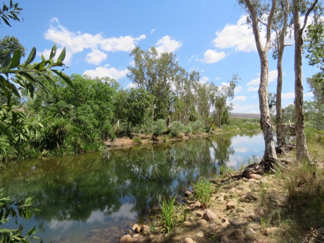
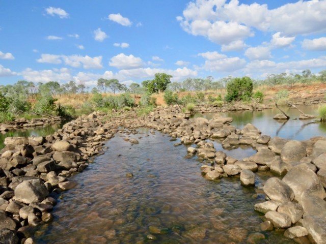
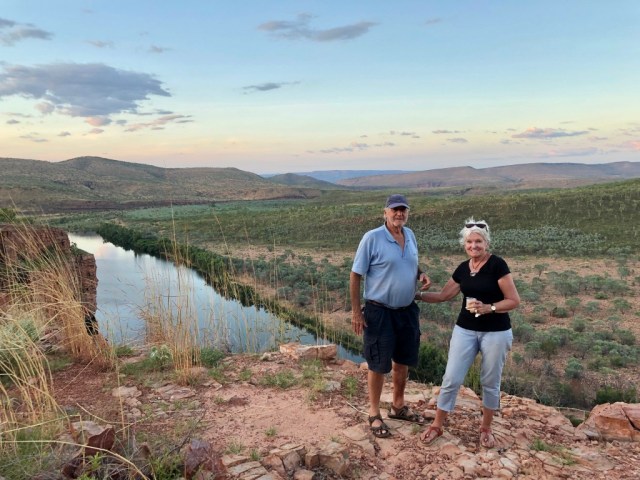
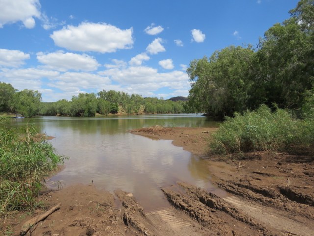
This also involved crossing a watercourse which appeared to me to be a river!

UNADJUSTEDNONRAW_thumb_2af

and then over some more stones

ucxD86GzSH2Oqqe0543WeQ_thumb_2bc

Then, whilst the vehicle was almost amphibious, we had a stunning view of the Homestead which is available for rent at over $3000 a night.  We were told it is pretty special and every comfort is provided with gourmet meals and staff included.

UNADJUSTEDNONRAW_thumb_2fc

The history of the station is interesting as it was a pastoral lease for many years and in 1991 a tall, handsome English aristocrat, named Will Burrell, arrived by helicopter and was interested in investing part of the fortune he inherited from his grandmother – the doyenne of the Penguin publishing empire.  He liked what he saw and bought the million acres as a working cattle ranch.  He intended to build a home for himself and envisioned a stylish getaway for adventurous travellers and ultimately a tourism venture with a range of accommodation from caravan park and camping to bungalows and tented cabins.  After a lot of hard work and millions of dollars his dream was realised and today it is a luxury wilderness park with a variety of tour options, guided walks and self drive itineraries.  It is now owned by an American company and open only from April to October because of weather conditions.

Our guide, Tommy, took us first to the great Boab tree where the Durack family camped in 1863 whilst droving their cattle from New South Wales to the Kimberley.  The tree has the Durack carved initials and has increased in size over the years.

UNADJUSTEDNONRAW_thumb_2b4

A very rough drive some time later brought us to Explosion Gorge where we left the vehicle and boarded a small punt for an hour on the water

UNADJUSTEDNONRAW_thumb_308

The colours are truly amazing and the red of the rock contrasted with the blue water and the varying hues of green of the bush.

Zc0pqxVvTpO5Q71X21nTcg_thumb_304UNADJUSTEDNONRAW_thumb_2ccIMG_3398

Then we spied a young freshwater crocodile just basking in the sun on the ledge.  He remained motionless for some time and then suddenly slid into the water with a huge splash.

pOS0wdGVQAGTXu9Cba3Ziw_thumb_2da

The name “Explosion Gorge” came about because Will Burrell apparently found a cache of dynamite one day and decided to go fishing.  What better to attract the fish than an explosive such as dynamite so he lit it and the rest is history!

On the rough ride to our sunset lookout we came across a beautiful nest made by a bower bird and in such a safe location that it can never be attacked by prey or fire.

VGnRZC09TXymNKOxyOt+cQ_thumb_2c4

A winding road led to the top of an escarpment where a plateau gave us an amazing view of the river and the whole landscape of the area.

Ytj5%7TKQ4WrUoVu9labVw_thumb_30c

The colours began to change as the sun sank lower and out came the champagne and beers – very welcome after the dusty drive!

N8MTZ5AKTbuqk3MaCJhrew_thumb_312

The moon reflected on the water before night fell making this a very special place.


Straight Road to Timber Creek

UNADJUSTEDNONRAW_thumb_218.jpg

The endless blue skies and long straight road led us out of Darwin south towards Katherine.  First we stopped at Pine Creek, a small town with a historical past.  I was interested to see that at one time the Chinese well outnumbered the Europeans who were all there for the Gold Rush.

35+53liATrK7HJ2UPkqSig_thumb_1c3.jpg

Today it is a quiet town which services the tourist industry mainly. However, it is a good stopping point to take a small rest before conquering many more kilometres.

IMG_3203.JPG

The iconic windmill which was so common in the past and now is seen less often in favour of solar power.

The next stop was Victoria River Roadhouse which also has accommodation and where many keen fishermen make their base before setting off on the Victoria River for barramundi.  It was very hot, very dry and there were lots of flies, so I was keen to keep moving but not before we called in for a chat with the owners.  Someone has a great sense of humour – see below:

gqhi728WTtSqZWLnqL7qHg_thumb_1c5.jpg

UNADJUSTEDNONRAW_thumb_1ca.jpg

Crocodiles live here so no swimming and great care is taken to put boats in and out of the water.

D8%oZ8MRSLigOnVfnCivJQ_thumb_1c8.jpg

The road began to curve after this and the scenery started to change to hills and escarpments. A nice change from the flat terrain we had become accustomed to. Now we are in The Big Country and this is where the Durack Family made their mark by settling on leases in the Northern Territory and walking hundreds of cattle up here from Queensland.  Several books have been written about the family at this time – the most well known being “Kings in Grass Castles” by Mary Durack.

UNADJUSTEDNONRAW_thumb_1cd.jpg

Finally we arrived at Timber Creek after some 610km from Darwin. It was a relief to find the Hotel/Motel/Caravan Park and the big surprise was the amazing location.  In a dry, dusty landscape, this was a little oasis.

xwCKR4lIRaOtoZDYYaYcAw_thumb_1d5.jpg

UNADJUSTEDNONRAW_thumb_1d4.jpg

Lovely grassy areas where children could play and shady barbecue and picnic areas were dotted around all with the creek in the background.  8MECkBhQRf6lNkFEZH4Y6g_thumb_1f4.jpgOHnUrFO0SL2qqMlSA%2fdg_thumb_1f2.jpg

UNADJUSTEDNONRAW_thumb_1fb.jpg

Huge timber trees along the creek edge obviously gave the place its name and the creek now has several resident freshwater crocodiles.  Wandering down to the water’s edge I was amazed to see quite a large croc just slowly surface from what seemed the calmest millpond.  There was absolutely no indication that the reptile was there!

UNADJUSTEDNONRAW_thumb_1d3.jpgDkiEgurOQwSHOmsHiNcj5g_thumb_201.jpg

Other residents of this gorgeous place are the fruit bats – of which we have lots in North Queensland and consider them a pest – however there are some people who think they are “cute”.

COQNBDOTTM+Rj4E0gMJgGg_thumb_1f8.jpg

This morning we drove up to a lookout and learned the story of the “Nackeroos” – The North Australian Observation Unit (NAOU)  or “Curtin’s Cowboys” which was formed in March 1942 after  the bombing of Darwin and was made up of a group of soldiers and Aboriginal guides who patrolled Northern Australia looking for signs of enemy activity.  They operated in small groups and most of the patrols were on horseback. They lived in the harsh bush conditions and were aided by Aboriginal locals who had knowledge of the area. Their story is inspiring and a monument has been built to honour them.

UNADJUSTEDNONRAW_thumb_1d9.jpg

IMG_3670.jpg

From this location is a great view of the town of Timber Creek and the Victoria River in the distance.

UNADJUSTEDNONRAW_thumb_1de.jpg

UNADJUSTEDNONRAW_thumb_1d8.jpg

Now it is on to Western Australia and Lake Argyle in the Kimberley – the road changes from here on!


A ROAD TRIP – THEN AND NOW

It has been almost three years since I wrote a blog – time has intervened in lots of ways and in spite of all my good intentions, the blog suffered even though we have made several wonderful trips since then. Intentions have been renewed and as we are about to embark on a huge road trip, I started to reflect on a similar one I made way back in 1969 – dare I say it “50 years ago”.

We will leave next week to drive to Darwin via Mt. Isa and then to Kakadu and on to the Kimberleys and the North West staying in places such as Lake Argyle, Derby, El Questro, Karijini National Park and down the coast to Perth, on to Albany and Esperance in the south west and then across the 1200 kms of the Nullarbor to South Australia, Adelaide and finally homeward bound through the bush. All this is anticipated to take about 7 weeks and quite a lot of forward planning has taken place.

In 1969, newly arrived from the UK, I was invited to make a trip from Perth to Darwin and down to Alice Springs and Ayers Rock. Of course I jumped at the chance, little knowing the hazards or what to expect. I had never even been in the bush before! I set off with a friend in an old Holden Panel Van with a roof rack on top holding gerry cans of fuel as well as our suitcases and water, our mattresses in the back along with food supplies and a stove. The road to Geraldton – some 400km – was sealed but the rest – all 11,300 km (or 7000 miles) was gravel or just plain red dirt. There were no fuel stops along the way after Geraldton.  I never paused to think about breakdowns or wrecked tyres……….

12-14-2013_3

The first time we needed to refuel I was told to get up on the roof, attach the hose to the gerry can and siphon the fuel down to the petrol tank.  Of course, I had never done this before and the result was a mouthful of fuel at the first attempt!

We drove many kilometres and stayed in remote bush clearings or on the coast and from time to time stayed on stations such as Fossil Downs, Frazier Downs and others near Derby and in the Gulf.  These were owned by friends of my friend and so I was lucky enough to experience life on huge stations – some larger than small countries in Europe. It was all mind boggling for a young 22 year old fresh from London and working for a film company.

Staying near Broome we visited the town often and got to know several locals.  I was fascinated by the story of the Japanese pearl divers and the influx of Asians all of whom seemed familiar to me after growing up in the Far East.  The children especially charmed me and we visited several schools and Missions all along the coast.

We had lots of adventures, staked a couple of tyres on lonely outback roads, met some fascinating people from the bush, learned a lot about Aboriginal folklore and The Dreamtime, appreciated the beauty of the rugged coastline and witnessed the birth of Kununurra and the Ord River project.  All these memories are imprinted on my mind and I wonder what I will feel revisiting some of these places.

When we arrived in Darwin we decided to go on to Alice Springs and Ayers Rock.  Tourists were not nearly as numerous then and at times we felt we had the place to ourselves.  The Resort was yet to be built and roads were very basic.  Back in Darwin we couldn’t face the long drive back so bought a couple of berths on the State Shipping Service ocean trader plying between Perth and Darwin

The ship was called the Koojarra and we spent ten days relaxing on the high seas with our trusty van in the hold! Calling in at various ports en route, we were able to go ashore and explore more of the coastal towns we had driven through just weeks before.

Koojarra

Now it is time to explore once again – but in a little more comfort this time and with many more facilities along the route including “glamping tents” and caravan parks.