ON THE ROAD WITH MORE VINES AND OLIVES

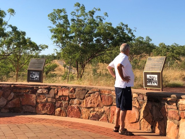
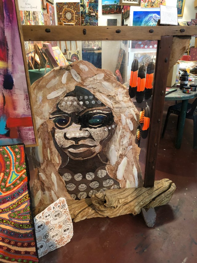
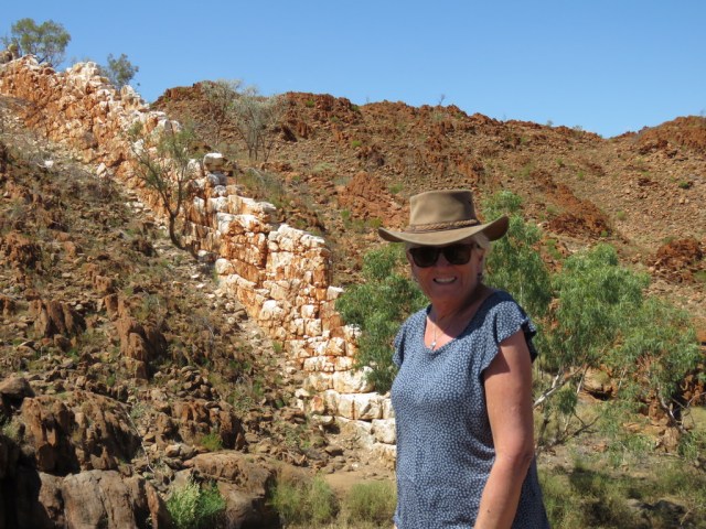
The Road Trip continues with over 14,000kms clocked up so far, we are feeling a little weary but still eager to discover and revisit places in South Australia.  Heritage towns definitely appeal and so we stopped at Burra – a small pastoral town in the mid north. It began as a mining township in 1851 and at one time supplied 5% of the world’s copper for 15 years. People came from Cornwall, Wales, Scotland and Germany  to work in the mines which closed in 1981.  It is a beautifully preserved town and it is here that the Burra Charter was adopted – this outlines the best practice standard for cultural heritage in Australia.

UNADJUSTEDNONRAW_thumb_8ec.jpg

Beautiful autumn colours are everywhere.

UNADJUSTEDNONRAW_thumb_8ed.jpg

The parks and gardens are relaxing and well maintained and tiny old miners’ cottages surround the lake in the middle of town.

UNADJUSTEDNONRAW_thumb_8ee.jpg

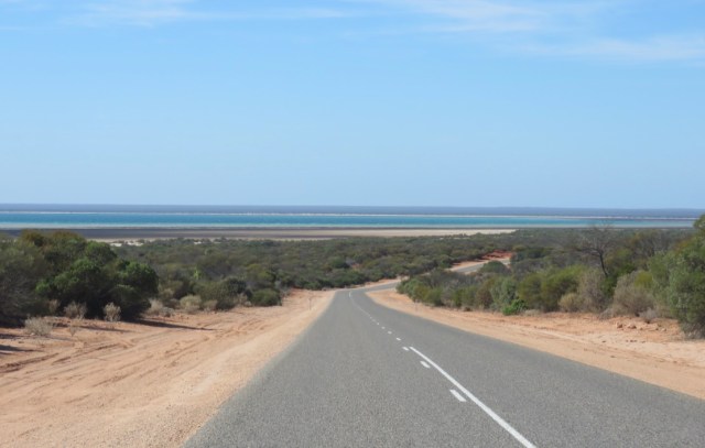
As we drove on the farming practices changed from wheat and sheep to vines and olives.  Beautiful trees line the highway and it is hard to believe this is the main thoroughfare to the city of Adelaide.

UNADJUSTEDNONRAW_thumb_8ef.jpg

Another pretty little town is Myponga – a very strange name and not easily forgotten!  Here we have a friend who grows olives and makes the most delicious olive oil and it is always a treat to visit.

UNADJUSTEDNONRAW_thumb_92e.jpg

UNADJUSTEDNONRAW_thumb_92d.jpg

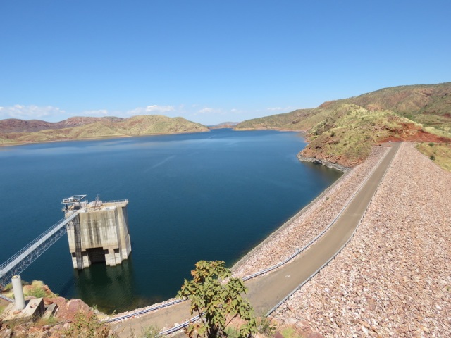
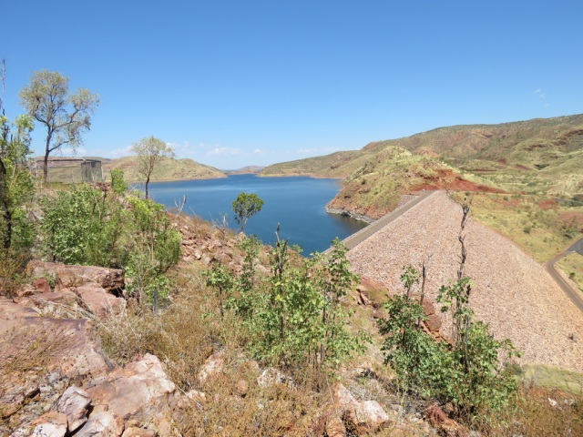
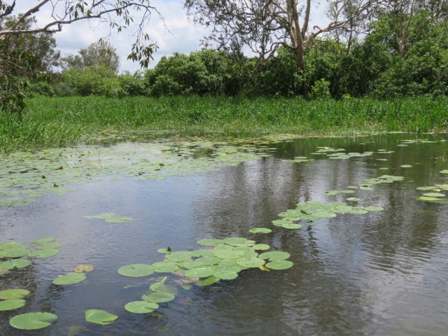
This time we had a picnic by the newly named Lake John – in memory of an old friend who loved this farm and is no longer with us.

UNADJUSTEDNONRAW_thumb_8f3.jpg

UNADJUSTEDNONRAW_thumb_8f5.jpg

Delicious fare of cold chicken, salads, cheeses and, of course, olives!

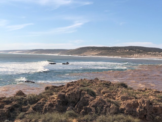
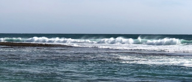
Not far from Myponga is the attractive little town of Victor Harbour which is on the coast and where, from the waterfront, horse drawn trams cross the causeway to Granite Island, home to a wild penguin colony.

k+S6CYuURISCXoVaoCALkQ_thumb_8f9.jpg

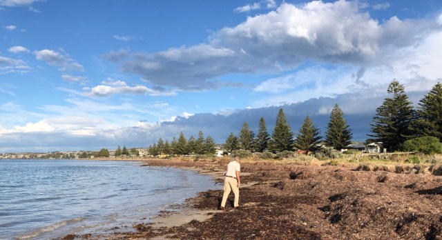
The beach is covered in seaweed at this time of year – perhaps another gourmet experience if it could be harvested and marketed for our palates!

zJ8Jh+KpRZ+deVQ8X+D7qA_thumb_8f8.jpg

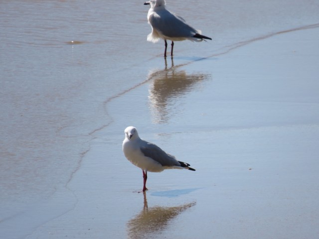
However, the parks and beaches are wonderful for recreation and relaxation.

UNADJUSTEDNONRAW_thumb_8fa.jpg

UNADJUSTEDNONRAW_thumb_8fc.jpg

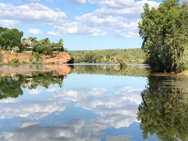
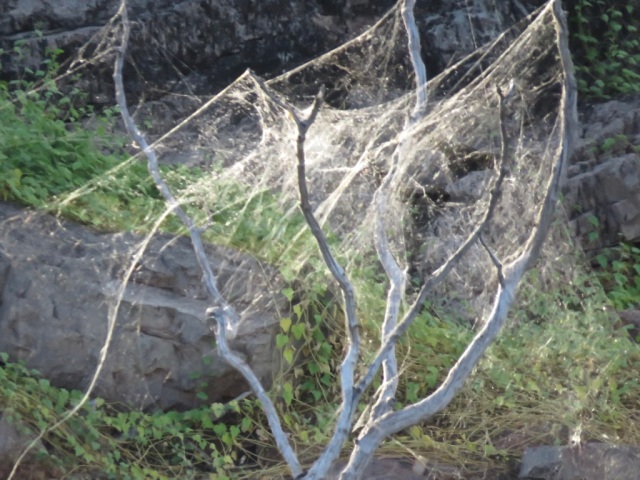
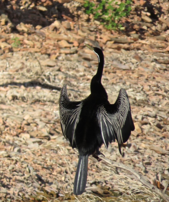
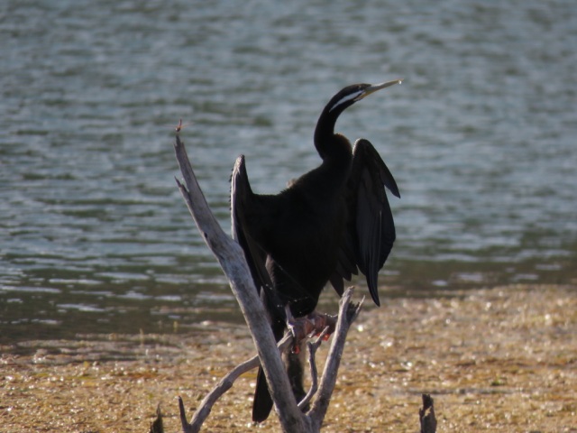
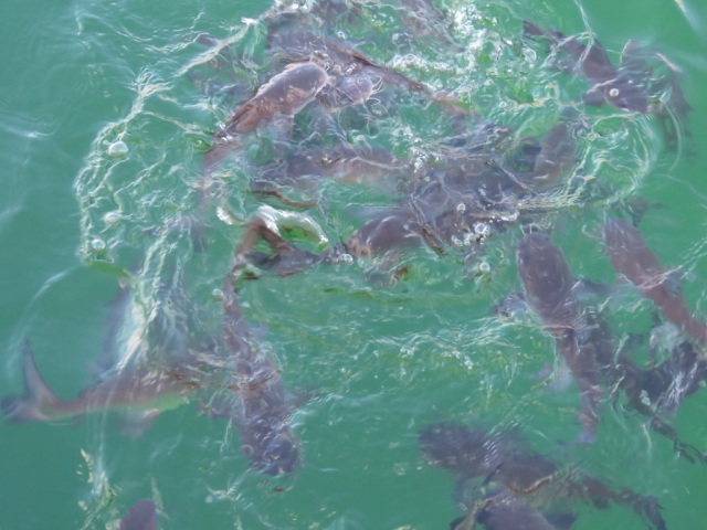
It was time to start heading north again and this time we drove along the Murray River seeing the views from the cliffs rather than on the water as we had done in a houseboat three years ago.

UNADJUSTEDNONRAW_thumb_902.jpg

c0qgQXbrTLCfi%6tNOEXsg_thumb_900.jpg

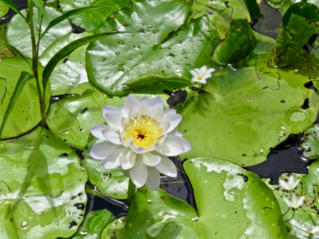
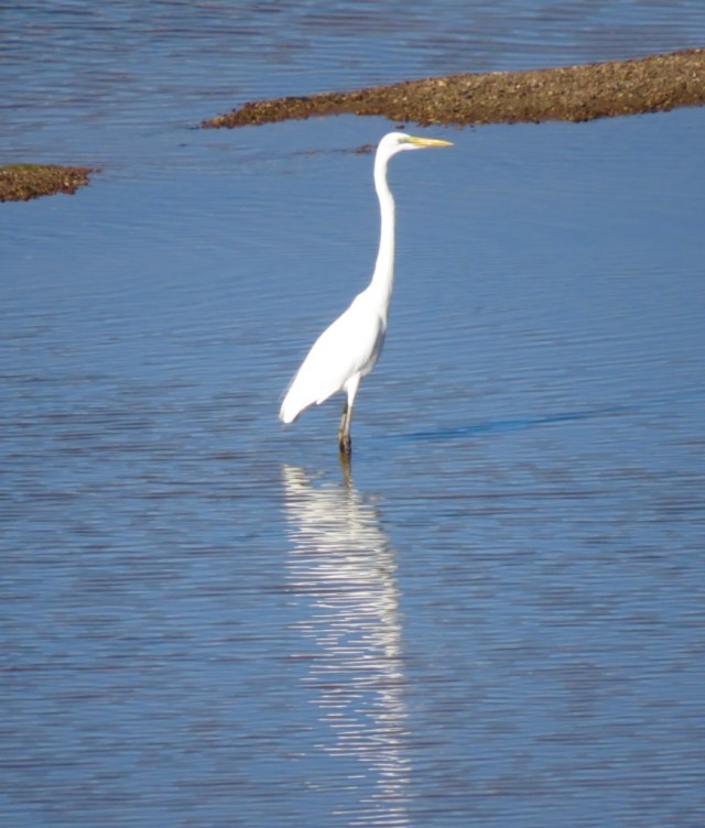
When it came time for a break we stopped at the river’s edge for a picnic and enjoyed the peace of the river and the birds.

UNADJUSTEDNONRAW_thumb_904.jpg

As we came closer to the New South Wales border, once again vines appeared and there were acres and acres of them as well as orchards and fruit processing plants.

UNADJUSTEDNONRAW_thumb_906.jpg

UNADJUSTEDNONRAW_thumb_908.jpg

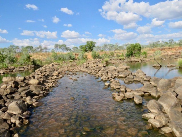
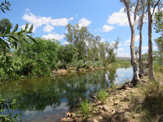
This area is home to the Murrumbidgee river, a major tributary of the Murray River and the second longest in Australia.  We found another quiet spot for a break here.

UNADJUSTEDNONRAW_thumb_90a.jpg

UNADJUSTEDNONRAW_thumb_90b.jpg

Now we are on the last leg of our trip and home beckons – but we have more than 1,350kms to go!


THE OPEN ROAD TO ESPERANCE

IMG_3680.JPG

Esperance is located on the pristine Southern Ocean coastline and is often described as “out of the way” but it is well worth the effort to get there.  It is surrounded by National Parks and many really beautiful beaches of pure white sand and crystal clear water in the most vibrant of turquoise hues.

We stayed in town where the foreshore meets the CBD and it is easy to walk to the many restaurants, shops and artisan galleries.  The iconic sculpture of a whale tail is surely the most impressive along this stretch of coastline.

UNADJUSTEDNONRAW_thumb_727.jpg

Just around the corner is the historic centre where old houses have been converted into galleries and gift shops and it is a really lovely place to wander and perhaps purchase an unusual gift to take home. What a great use for these historic buildings – keeping stories of the past alive.

The Great Ocean Drive is purported to be one of the most beautiful drives in Australia and it seemed that at every bend there was jaw dropping scenery.  Towering cliffs, rugged bush, red rocks dropping into powdery white sand really does present an artists’ palette and even the most sceptic would agree that this is quite incredible.

UNADJUSTEDNONRAW_thumb_82d.jpg

UNADJUSTEDNONRAW_thumb_82e.jpgUNADJUSTEDNONRAW_thumb_82c.jpg

Twilight beach is one of the most photographed in the area but each beach had its own special brand of beauty.

UNADJUSTEDNONRAW_thumb_833.jpg

UNADJUSTEDNONRAW_thumb_834.jpg


UNADJUSTEDNONRAW_thumb_839.jpg

Many of the beaches had access via wooden walkways and stairs and safe swimming from either the flat rocks or the sandy beach is possible.

Beyond is the Recherche Archipelago with more than 110 islands offering perfect spots for diving, swimming, snorkelling and fishing.

Then, wearied by all this scenic beauty but not to be outdone, we drove out to Cape Le Grand National Park where we had been told of more jaw dropping scenery.  This is possibly the most spectacular of the Southern Coastal National Parks and is about half an hour east of Esperance. The park’s rolling heathlands are home to pygmy possums and western grey kangaroos – and these can often be seen lounging on the white sandy beaches or skipping through the campsites and carparks and socialising with visitors.

iUuIAy0ET5yV3wY556CVAw_thumb_736.jpg

We gasped when we saw Lucky Bay – it is honestly the most beautiful beach I have seen so far.

gQbGLe79SpeU%NE5kjmN1A_thumb_74a.jpg

UNADJUSTEDNONRAW_thumb_841.jpg

Nearby is “Whistling Rock” so named because the wind whistles through the gaps and makes quite a musical sound.

ast0LtoESVqCDb9JzZqtYg_thumb_74c.jpg

Massive rock outcrops form a chain of peaks and Frenchman’s Cap was named by surveyor Alexander Forrest during an expedition in 1870 because it resembled the hats worn by French troops in the 1800’s.

CwUYL3drSLqUTuk02AHCKA_thumb_72e.jpg

Around 20 kms of coastal track link many of the spectacular coastal sections and rock fishing is popular from several of them.

iP+FzZT%T8aPWC4m63jtwg_thumb_751.jpg

This is truly a fabulous part of the country to visit and we are told that wildflower season is magnificent with flowers of all types, including dense thickets of banksia, putting on a display.  I guess we will just have to come back!


The Coastal Road To Kalbarri and Perth

mN5gULQUTb298ukYO5SEfg_thumb_4b7.jpg

There is something special about being close to the sea – at least for me.  I am in my element when watching the moods of the ocean, the vegetation, coastal scenery and the different lifestyles of the communities all along the coastal stretch.  For a while we are out of the red dust, the dramatic landscapes and rock faces, the vast distances between places – not to mention the flies and the heat!

Leaving Shark Bay we visited the remarkable Hamelin Pool stromatolites.  I had no idea what these were until we visited the Discovery Centre and so we were keen to see what it was all about.  These Hamelin Pool stromatolites are the oldest and largest living fossils on earth.  These are considered “living fossils” and are part of the Earth’s evolutionary history.

UNADJUSTEDNONRAW_thumb_4e6.jpg

Now part of the Word Heritage Area, a purpose built jetty has been built over these amazing life forms so people can walk and observe without causing damage. This gives everyone has a chance to see what is of great interest to botanists and geologists and give an indication of what the earth may have looked like about 3.7 billion years ago when stromatolites grew widespread across the water.

HZylG72FTVavoNaA8SHyug_thumb_4be.jpg

UNADJUSTEDNONRAW_thumb_4bc.jpg

Some scientists are now saying that this is what life on Mars may look like right now.

An easier explanation is the following quote:

The oldest Stromatolites in the world are found in Western Australia, and date to 3.7 billion years old. As such, the stromatolites provide a record of local environmental changes. Hamelin Pool in Western Australia is one of only four places on earth where living marine stromatolites exist and the location contains by far the biggest colony on earth. 

Stromatolites which are found up to a metre high are believed to grow at a maximum of 0.3mm per year – they are truly “living fossils”. 80% of the history of all life was stromatolites – for that time, stromatolites were king.

Our next destination was Kalbarri.  This little town on the mouth of the Murchison River is known for its seaside cliffs, estuary beaches, pelicans and birdlife and the National Park nearby.  Once again there are gorges and and natural bridge forms and several scenic walks and climbs for those who are more adventurous.

When I did my first Road Trip all those years ago, there was nothing here except a couple of holiday houses and fishing shacks.  Now it is a thriving tourist destination and very popular with families.  The first thing you notice on driving into the village is the river – which is currently very muddy and so it is easy to see where the river meets the ocean.

UNADJUSTEDNONRAW_thumb_4ed.jpg

There are sandy beaches close by which are protected by a reef – and the thundering surf beyond is quite spectacular.

UNADJUSTEDNONRAW_thumb_4ea.jpg

m1kVpf6iT2SF4OtP62yWdw_thumb_4ef.jpg

Red Bluff is where ancient rock meets the ocean and the history of this area is interesting.

UNADJUSTEDNONRAW_thumb_4f0.jpg

The first European people to visit the area were the crew of the trading ship Batavia belonging to the Dutch East India Company who apparently put ashore two mutinous crew members here.  The wreck of another ship – the Zuytdorp – which sank in 1712 is also here.

There is a lovely little walk along the cliff top which illustrates clearly the problem ships would have had sailing into this area.

UNADJUSTEDNONRAW_thumb_4f3.jpg

UNADJUSTEDNONRAW_thumb_4f2.jpg

UNADJUSTEDNONRAW_thumb_4f5.jpg

At the bottom of the cliff is a trail from the beach leading up to the top and here the contrast between the red rock and the beach is obvious.  This is a popular fishing spot.

UNADJUSTEDNONRAW_thumb_4f7.jpg

Bird life is prolific and at times, walking on the beach, the only company you have is our feathered friends.

UNADJUSTEDNONRAW_thumb_4fa.jpg

UNADJUSTEDNONRAW_thumb_4c9.jpg

UNADJUSTEDNONRAW_thumb_508.jpg

Another interesting place to visit is Port Gregory and the “Pink Lake” .  This is on the road south of Kalbarri and we were told one should see it in the morning when the sun is overhead.  We were not disappointed.

UNADJUSTEDNONRAW_thumb_51b.jpg

3OGhjb1aSXOfP7aKuU4fTA_thumb_510.jpg

UNADJUSTEDNONRAW_thumb_516.jpg

The Hutt Lagoon has a pink hue created by the presence of carotenoid producing algae which is a source of B carotene, a food colouring agent and a source of Vitamin A.   There are other pink lakes in WA and hopefully we will get to see more on this “Big Loop”.

History has always been a passion of mine and so a stop at Lytton close by was a must as this was a Convict Hiring Station and there are several ruins and many tales to tell here.

UNADJUSTEDNONRAW_thumb_522.jpg

And finally – not far from Perth we came across an amazing sight – a desert in the bush. This is The Pinnacles – in Nambung National Park and is incredible.

UNADJUSTEDNONRAW_thumb_528.jpg

These are limestone formations and some reach 3.5m.  Some are jagged, sharp edged columns and others are smooth and rounded.  There are thousands of them and they literally take your breath away.

UNADJUSTEDNONRAW_thumb_529.jpg

EmlCom0fTkOaIxquTqFujQ_thumb_52b.jpg

And my favourite image is this one, of a little resident of the area out for his morning munchies!

xGE++VAPT4uVNM2FprqMtw_thumb_530.jpg


Dusty Road to Derby

NUC5UPERRby5aWs+MlRXHA_thumb_3a1

Driving on these dusty roads is not without some danger – especially when you meet one of the huge road trains – the most sensible thing to do is stop and wait for both the road train and the dust to pass!  Fortunately the trip to Derby was enjoyable with very little traffic and lots of contrasting colours on the way.  We even had time to stop and have a picnic lunch on the back of the vehicle.

UNADJUSTEDNONRAW_thumb_3a4

Right alongside was another huge termite mound and having learned of the aboriginal significance of these mounds, I was wondering if this one contained the remains of a loved one.  It was again an unusual shape compared to others we have seen on this road trip.

2RbHuyZLSTioXrJxhiG%nQ_thumb_3a2

Finally we arrived in Derby which is a small outback town on the edge of the King Sound.  Its claim to fame is having the highest tides of any Australian port 11m (or 36 feet) which leaves the town surrounded by vast mud flats and mangroves.  We were advised to go down to the town jetty – the Derby Wharf – to watch the sunset.  Each evening a stream of people arrive with their chairs and eskies and settle down to watch the display and/or to fish.  We were not disappointed, in spite of cloud cover the colours were magnificent.

UNADJUSTEDNONRAW_thumb_3cb

IMG_3811

There is quite a lot of history with this town and we found the Boab Prison Tree seven kilometres out of town.  This is a 1500 year old boab tree that was used as an overnight lockup for prisoners.  Before Derby was established in 1883 Aboriginal people were kidnapped from the West Kimberley by settlers who wanted divers and workers for the pearling boats in Broome.  They rounded people up, put them in chains and marched them up the coast. Some held their captives at the boab tree whilst waiting for a boat.  This seems incomprehensible to us today and doesn’t bear thinking about.  However it is now a “Site of Significance” to the local Aboriginal people and the tree is protected under the Heritage Act.

UNADJUSTEDNONRAW_thumb_3a9

UNADJUSTEDNONRAW_thumb_3a8

There is a sign declaring that snakes are known to inhabit the tree and not to go near it – it is protected by a fence these days.

With a population of more than half being Aboriginal and with several communities nearby, there are a couple of art galleries to visit.  One was closed but the other was definitely worth a visit and I would recommend to anyone in the area to stop by.  It is fascinating and the owner, Mark Norval, is an artist himself who has spent more than 40 years in the area and has helped and encouraged many local artists.

UNADJUSTEDNONRAW_thumb_3d7

Several local people had come to the gallery that day and were sitting outside painting which was fascinating to watch.  They are extremely shy and I asked if I could take their photos and was pleased to be able to converse for a short time with them.

UNADJUSTEDNONRAW_thumb_3d6UNADJUSTEDNONRAW_thumb_3d4UNADJUSTEDNONRAW_thumb_3d5

Inside was an incredible array of art and artefacts and I was very taken with a couple of pieces so purchased them and was delighted to find the young artist had just arrived, so she agreed to meet me and have a photo taken with the painting I had chosen.

IMG_3823

Mark himself has some incredible work there and two pieces, which were not for sale, left me quite gobsmacked.  They were portraits done on perspex so each side had a different face but was constructed with the same medium – paint, lace, bark, leaves and shells.

IMG_3820

and the other side

IMG_3821

IMG_3825

IMG_3824

I could have spent hours here at the gallery and spent hundreds of dollars but was pulled away and on we drove, to another straight road towards Broome.

UNADJUSTEDNONRAW_thumb_3d8


The Red Road Deep in the Kimberley

mme5c2bhS9mnbit%LJjwkg_thumb_338

The road to Fitzroy Crossing and beyond is long and parts of it are gravel and the soil very red.  This makes for quite stunning colours everywhere even though the car gets covered in a fine silt.

We had heard about China Wall near Hall’s Creek and decided to make a little detour to see what it was all about.  Located on a private property, we had to enter through the station gate and drive on a rough track for about six kilometres and suddenly, there it was!

UNADJUSTEDNONRAW_thumb_320

This was so surprising and is a natural vein of sub-vertical white quartz rising up to 6 metres above the surrounding country in some places.  It rises high out of the ground and then disappears again only to reappear further on.  Apparently it transects the country for many kilometres but we only saw this section.

UNADJUSTEDNONRAW_thumb_32f

Aborigines have a theory about how this came about but for us, it was just a fabulous little detour to witness a wall similar to the Great Wall only right here in the Outback!

UNADJUSTEDNONRAW_thumb_336

We came across many more termite mounds but these were a different shape and I have to admit a fascination for them.  A local told us that the Aborigines used them as a burial place for their dead by placing the remains of the deceased inside the mound which would then be sealed naturally by termite activity.  Thus these formations are sacred to many tribes and explains why, in some places especially in the Northern Territory, we saw mounds with clothes placed over them – a t shirt, cap or a dress.

UNADJUSTEDNONRAW_thumb_32b

Fitzroy Crossing was our next stop and this place I remember from my road trip way back in 1969.  There wasn’t much there then but now it is quite a thriving community which serves the stations in the area – many of which are now owned by Indigenous groups.  It is very, very dry at the moment, so the mighty Fitzroy River looked a bit sad.

jGCePUs%S56bblOIYznXFQ_thumb_339

UNADJUSTEDNONRAW_thumb_33b

KXmIj9wFRYKVHn+hftfqDA_thumb_33c.jpg

We did see some water birds making most of the calm conditions.

kQ8TI%9RRx6e1YjsHSKcTg_thumb_33d

glxb5TTMRdmK6rp0HXW0SQ_thumb_343

I also remember doing a little boat trip down Geikie Gorge when I stayed on Fossil Downs Station all those years ago.  The gorge runs through part of the station and I remember being awestruck by the cliffs and the colours of the rock.  Sadly there were no boat tours available yesterday but we walked down to the water’s edge and looked at Linyjiya Rock – or Old Man’s Rock – the story here from the Dreamtime is that an old, blind elder left his tribe to go wandering and drowned.  He sneezed and sighed before he sank to the bottom and it is said that if you sit quietly and listen, you will hear the sighs of the old man.

YFXTsFd6SOy7PoatcuFy4Q_thumb_349.jpg

We left the gorge and continued on the gravel road towards Tunnel Creek and Windjana Gorge before joining the Gibb River Road.  Along a very lonely stretch we came across a young man on a bicycle.  We stopped to see if he was OK only to learn that he was actually cycling to Kununurra some 550km away along the notoriously rough stretch of road.  No smooth riding for him!  We gave him cold water, learned he was from the UK and decided he must be mad – but a very happy mad man!

qB57ycTJTbqqC91CQbcxjA_thumb_352.jpg

This is Boab country and as we neared Tunnel Creek National Park we drove into a landscape peppered with black rocks, cliffs and hilly mounds.  This is an ancient 350 million year old Devonian Reef and is now part of the WA National Parks.

orlfWLkiQBCmY7nWSdPM5w_thumb_34d

wBSVyb05S4CS7iET+U3xdw_thumb_354

MjjkAi0STkuldLd2hEFSPg_thumb_353

Tunnel Creek itself is a 750m long underground water worn natural tunnel and it is possible to wade all the way through.  We opted to walk to the entrance and learn the stories that lie beneath the walls.

FHErkEKzSxWM0IpXmU2IEg_thumb_358

Jandamarra was a young man of the Banuba tribe at the time of white colonisation of the Kimberley.  He became entangled in a war between two worlds. He learnt English and worked with stock, horsemanship and shooting. However he became greatly attracted to the secret life of the Banuba male world of ritual, secret sites, mythology and  the law of the Banuba country.  He left the station and took up life with the tribe but then returned to station life, turning his back on his Aboriginality.  Finally he went back to the tribe and led a resistance against the settlers.  In 1894 he tragically shot his friend, the white policeman he had worked with for years, released prisoners and distributed weapons. An armed resistance followed and Jandmarra was killed here at Tunnel Creek. The area is obviously very sacred to the indigenous people but is also one of interest and history to everyone.

SPUG9PFyQUODgIR%rHV2aA_thumb_360

eYA9dbK1Q7u3Qp29728RSA_thumb_362

The entrance to the tunnel where Jandamarra hid

+aEhfJC4QhSAyxhVd%qQZQ_thumb_363

We went on to Windjana Gorge which is part of the Jandamarra story and is an open air gorge through the Lennard River.  There are beautiful rock formations and freshwater crocodiles, birds, bats and other wildlife as well as amazing fossils which I managed to find. The entrance to the gorge is narrow and would have been a perfect hideout for Jandamarra and his gang.

D72kmWdtTfi2t3gqxB8Mzw_thumb_370

IMG_3513

The gorge itself is quite dry but the little water there is had a few little crocodiles as well as a number of water birds searching for food.

The rock formations are impressive and the shady areas along the water are a respite from the intense heat of the day.

jamg7dxcQdqpfWq8uA5kqg_thumb_397

UNADJUSTEDNONRAW_thumb_371

With our minds full of history of the past and totally absorbed by the beauty of the area and tired from walking the trails, we went back to the car and headed on to our next stop – the little town of Derby.


The Road ahead to El Questro

The road is getting more picturesque as we journey on but  I have to admit that the tiny bush flies and the intense heat is quite trying at times. However all that is forgotten as we drive deeper into the Kimberley area.

UNADJUSTEDNONRAW_thumb_2f3

Our home for the next two days was a safari tent at Emma Gorge, part of the El Questro station.  We decided to go “glamping” after our wonderful adventures in Africa in similar accommodation.  We didn’t think about the heat this time!

We organised a trip to Explosion Gorge and Branko’s lookout for sunset drinks but first we had to find a picnic spot to satisfy our hunger – it was lunchtime and the drive to El Questro station passes a beautiful waterhole called “Jackeroo Waterhole” and this was the ideal place to relax for half an hour before a bone shaking 4 wheel drive tour.

UNADJUSTEDNONRAW_thumb_2b2

The trip we booked is closed to public vehicles as the terrain is so rough.  We boarded an open safari type vehicle with six other guests and set off along the roughest track I have yet experienced!

w1YIbcksTwKWzDMZIJVZog_thumb_2c0
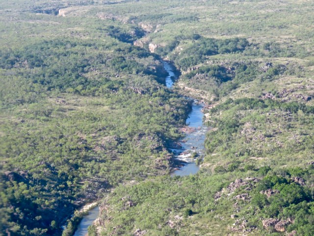
This also involved crossing a watercourse which appeared to me to be a river!

UNADJUSTEDNONRAW_thumb_2af

and then over some more stones

ucxD86GzSH2Oqqe0543WeQ_thumb_2bc

Then, whilst the vehicle was almost amphibious, we had a stunning view of the Homestead which is available for rent at over $3000 a night.  We were told it is pretty special and every comfort is provided with gourmet meals and staff included.

UNADJUSTEDNONRAW_thumb_2fc

The history of the station is interesting as it was a pastoral lease for many years and in 1991 a tall, handsome English aristocrat, named Will Burrell, arrived by helicopter and was interested in investing part of the fortune he inherited from his grandmother – the doyenne of the Penguin publishing empire.  He liked what he saw and bought the million acres as a working cattle ranch.  He intended to build a home for himself and envisioned a stylish getaway for adventurous travellers and ultimately a tourism venture with a range of accommodation from caravan park and camping to bungalows and tented cabins.  After a lot of hard work and millions of dollars his dream was realised and today it is a luxury wilderness park with a variety of tour options, guided walks and self drive itineraries.  It is now owned by an American company and open only from April to October because of weather conditions.

Our guide, Tommy, took us first to the great Boab tree where the Durack family camped in 1863 whilst droving their cattle from New South Wales to the Kimberley.  The tree has the Durack carved initials and has increased in size over the years.

UNADJUSTEDNONRAW_thumb_2b4

A very rough drive some time later brought us to Explosion Gorge where we left the vehicle and boarded a small punt for an hour on the water

UNADJUSTEDNONRAW_thumb_308

The colours are truly amazing and the red of the rock contrasted with the blue water and the varying hues of green of the bush.

Zc0pqxVvTpO5Q71X21nTcg_thumb_304UNADJUSTEDNONRAW_thumb_2ccIMG_3398

Then we spied a young freshwater crocodile just basking in the sun on the ledge.  He remained motionless for some time and then suddenly slid into the water with a huge splash.

pOS0wdGVQAGTXu9Cba3Ziw_thumb_2da

The name “Explosion Gorge” came about because Will Burrell apparently found a cache of dynamite one day and decided to go fishing.  What better to attract the fish than an explosive such as dynamite so he lit it and the rest is history!

On the rough ride to our sunset lookout we came across a beautiful nest made by a bower bird and in such a safe location that it can never be attacked by prey or fire.

VGnRZC09TXymNKOxyOt+cQ_thumb_2c4

A winding road led to the top of an escarpment where a plateau gave us an amazing view of the river and the whole landscape of the area.

Ytj5%7TKQ4WrUoVu9labVw_thumb_30c

The colours began to change as the sun sank lower and out came the champagne and beers – very welcome after the dusty drive!

N8MTZ5AKTbuqk3MaCJhrew_thumb_312

The moon reflected on the water before night fell making this a very special place.


The Red Road to Lake Argyle


UNADJUSTEDNONRAW_thumb_225.jpg

The scenery is now changing on this Big Loop around Australia and the road to Lake Argyle turns off the highway and winds through the stunning Carr Boyd ranges.  At every turn there is an amazing view and the colours of the soil together with the golden grasses and deep green of the thick shrubs would make an artist’s eyes water.

UNADJUSTEDNONRAW_thumb_215.jpg

We crossed several water courses  and finally came to the historic Argyle Downs Homestead.  The home of the Durack family, this house was removed stone by stone when the property was flooded as part of the Ord River Irrigation Scheme and the formation of Lake Argyle.  Now it has been rebuilt and  and become a museum which serves as a reminder of the huge contribution that the family made in the pastoral industry of the North West.

IMG_3686 2

UNADJUSTEDNONRAW_thumb_226.jpgUNADJUSTEDNONRAW_thumb_1e9.jpg

Lake Argyle is Australia’s largest freshwater lake with a surface area of over 1000 sq. km and has a shoreline of 900kms. It is now home to around 26 species of native fish, 30,000 freshwater crocodiles and three varieties of freshwater tortoise.  Hard to imagine that is was all once pastoral land which was home to native people, pastoralists and wildlife.

We stayed at the Lake Argyle Resort which has a beautiful infinity pool with views across the ranges and over the valley.

u3t2q9btTPOpbTCP4l20XA_thumb_217

In the evenings the setting sun gives a golden glow to the landscape visible from every part of the property.

UNADJUSTEDNONRAW_thumb_22e.jpg

A great way to learn about Lake Argyle and the huge project undertaken some fifty years ago is to take a sunset cruise.  We set off with an introductory talk and an explanation about the building of the dam wall which, in itself, was an amazing feat.

UNADJUSTEDNONRAW_thumb_252.jpg

UNADJUSTEDNONRAW_thumb_251.jpg

Then it was a calm cruise across the massive lake watching for wildlife and, of course, the crocodiles!  A sheen across the water and in the trees at one particular spot revealed the story of the Golden Orb spider. This spider never leaves the web and spins a web made of silk like thread which is extremely strong and has been made into a silk fabric. Scientists are now working on making a synthetic prototype which may be used in the future.

UNADJUSTEDNONRAW_thumb_25f.jpg

E%VxWwUeTaewRe3Hcsxk6w_thumb_26d.jpg

3Nq1JPc5TnCRfYdl+UR%uQ_thumb_27c.jpg

We spotted a variety of water birds waiting for their prey and did a spot of fish feeding

1xDtkfrMQiSQDjXOUAf88A_thumb_266.jpg

UNADJUSTEDNONRAW_thumb_26f.jpg

UNADJUSTEDNONRAW_thumb_281.jpg

UNADJUSTEDNONRAW_thumb_28e.jpg

UNADJUSTEDNONRAW_thumb_23b.jpg

The lake throws incredible reflections during the afternoon and today, being so calm, was the perfect example of this.

UNADJUSTEDNONRAW_thumb_292.jpg


Our Guide and Skipper, Tracy, then gave a history of the area and the massive project which also resulted in several little islands being formed.  She took us to “The Bay of Islands” and nudged the boat up onto the shore.  Several little Walleroos came to investigate knowing that this was “feeding time”.

4VphF9o0Sb+3M%IUc1XebQ_thumb_296.jpg

Then we spied a freshwater crocodile – these have longer more pointed snouts than their fearsome saltwater cousins and said to be shy of humans.  Nevertheless, I don’t think I would like to get tangled up with one.

9N75mGRaRBSx9lOgL4AcWg_thumb_2a2.jpg

Having said that, Tracy motored to a bay she takes people swimming at and encouraged us all to take a dip.  Crocodiles or not, we jumped in and felt the beautifully soft water cool us down very quickly.

UNADJUSTEDNONRAW_thumb_23f.jpg

The sun began to set and it was a magical time of day.  With champagne or beer in hand it was the end of a day on Lake Argyle.

UNADJUSTEDNONRAW_thumb_244.jpg


Straight Road to Timber Creek

UNADJUSTEDNONRAW_thumb_218.jpg

The endless blue skies and long straight road led us out of Darwin south towards Katherine.  First we stopped at Pine Creek, a small town with a historical past.  I was interested to see that at one time the Chinese well outnumbered the Europeans who were all there for the Gold Rush.

35+53liATrK7HJ2UPkqSig_thumb_1c3.jpg

Today it is a quiet town which services the tourist industry mainly. However, it is a good stopping point to take a small rest before conquering many more kilometres.

IMG_3203.JPG

The iconic windmill which was so common in the past and now is seen less often in favour of solar power.

The next stop was Victoria River Roadhouse which also has accommodation and where many keen fishermen make their base before setting off on the Victoria River for barramundi.  It was very hot, very dry and there were lots of flies, so I was keen to keep moving but not before we called in for a chat with the owners.  Someone has a great sense of humour – see below:

gqhi728WTtSqZWLnqL7qHg_thumb_1c5.jpg

UNADJUSTEDNONRAW_thumb_1ca.jpg

Crocodiles live here so no swimming and great care is taken to put boats in and out of the water.

D8%oZ8MRSLigOnVfnCivJQ_thumb_1c8.jpg

The road began to curve after this and the scenery started to change to hills and escarpments. A nice change from the flat terrain we had become accustomed to. Now we are in The Big Country and this is where the Durack Family made their mark by settling on leases in the Northern Territory and walking hundreds of cattle up here from Queensland.  Several books have been written about the family at this time – the most well known being “Kings in Grass Castles” by Mary Durack.

UNADJUSTEDNONRAW_thumb_1cd.jpg

Finally we arrived at Timber Creek after some 610km from Darwin. It was a relief to find the Hotel/Motel/Caravan Park and the big surprise was the amazing location.  In a dry, dusty landscape, this was a little oasis.

xwCKR4lIRaOtoZDYYaYcAw_thumb_1d5.jpg

UNADJUSTEDNONRAW_thumb_1d4.jpg

Lovely grassy areas where children could play and shady barbecue and picnic areas were dotted around all with the creek in the background.  8MECkBhQRf6lNkFEZH4Y6g_thumb_1f4.jpgOHnUrFO0SL2qqMlSA%2fdg_thumb_1f2.jpg

UNADJUSTEDNONRAW_thumb_1fb.jpg

Huge timber trees along the creek edge obviously gave the place its name and the creek now has several resident freshwater crocodiles.  Wandering down to the water’s edge I was amazed to see quite a large croc just slowly surface from what seemed the calmest millpond.  There was absolutely no indication that the reptile was there!

UNADJUSTEDNONRAW_thumb_1d3.jpgDkiEgurOQwSHOmsHiNcj5g_thumb_201.jpg

Other residents of this gorgeous place are the fruit bats – of which we have lots in North Queensland and consider them a pest – however there are some people who think they are “cute”.

COQNBDOTTM+Rj4E0gMJgGg_thumb_1f8.jpg

This morning we drove up to a lookout and learned the story of the “Nackeroos” – The North Australian Observation Unit (NAOU)  or “Curtin’s Cowboys” which was formed in March 1942 after  the bombing of Darwin and was made up of a group of soldiers and Aboriginal guides who patrolled Northern Australia looking for signs of enemy activity.  They operated in small groups and most of the patrols were on horseback. They lived in the harsh bush conditions and were aided by Aboriginal locals who had knowledge of the area. Their story is inspiring and a monument has been built to honour them.

UNADJUSTEDNONRAW_thumb_1d9.jpg

IMG_3670.jpg

From this location is a great view of the town of Timber Creek and the Victoria River in the distance.

UNADJUSTEDNONRAW_thumb_1de.jpg

UNADJUSTEDNONRAW_thumb_1d8.jpg

Now it is on to Western Australia and Lake Argyle in the Kimberley – the road changes from here on!


The Road Leads to Darwin

Darwin, known as The Gateway to Northern Australia, is a lovely tropical city.  With so much history to devour, you really need several days here.  Then there are  the world famous markets, festivals, cafes and a thriving arts scene and yet things move at a slower pace than down south and I can’t help feeling this would be a great place to settle for a while.

QG2KVwDMTMiDRqtTot2Jwg_thumb_1a4.jpg

For a start there are fabulous sunsets and this one is from the balcony of a friend’s apartment very close to the city.  There don’t seem to be traffic problems and on a drive to the museum yesterday this is what we came across :

+9CcVvcXQby+BokdNCADMQ_thumb_185.jpg


FAe4PuxpQMuoSa0T%EUrSQ_thumb_186.jpg

Hardly what you expect to see in the middle of a city!

We walked along the Esplanade and came to The Waterfront area which is both residential and recreational with a big wave pool and swimming lagoon and a park for the kids.

UNADJUSTEDNONRAW_thumb_1a9.jpg

5pApV90HTUaOQTinrD%0%w_thumb_1aa.jpg

There are restaurants galore and we settled for a coffee before walking back – with the bonus of a lift to take us back up to the Esplanade thus avoiding the slog of walking up the hill in the heat!

One activity the Darwinites love apparently is the Deckchair Cinema.  This is down by the water and screens films nightly with a bar and restaurant food available if you don’t want to bring a picnic. How tropical is that?!

UNADJUSTEDNONRAW_thumb_1a8.jpg

F0WgnzexRzGE8niBvbO7wA_thumb_1a3.jpg

Keen to see the MAGNT (Museum and Art Gallery Northern Territory) we drove through the attractive seaside suburb of Fannie Bay and past the Botanical Gardens to find the Northern Territory’s premier cultural organisation set in a scenic coastal location at Bullocky Point with a restaurant/cafe alongside with views over the bay. The museum features collections of art from the region as well as natural science, history and culture. There is a lot of local history and there is a huge exhibit featuring Cyclone Tracey which devastated the city on Christmas Eve in 1974.

The collection of animals, insects, reptiles, shells and sea life is huge and it is all presented so well and the exhibits are so real that it is easy to imagine all this outside in the environment.

UNADJUSTEDNONRAW_thumb_1af.jpg

UNADJUSTEDNONRAW_thumb_1b0.jpg

This is the little Jacana and babies – we saw several in Kakadu but they are shy and elusive so to be able to gaze upon these without missing anything is a real bonus.

IMG_3599


UNADJUSTEDNONRAW_thumb_1a5.jpg

Some fascinating aboriginal art is presented along with comprehensive explanations and even a desert artist shows her skill with a paintbrush fashioned from the tail hair of a dog – her intricate and steady lines were quite amazing.  Her hand never faltered.

UNADJUSTEDNONRAW_thumb_1b3.jpg

One immersive exhibition tells the story of the didgeridoo – or yidaki as it is known here. It illustrates the importance of the instrument in Aboriginal life and culture and begins with exploring a stringybark forest to find the right tree and then carving the yidaki and finally experiencing the mesmerising power of the sounds.  The painting on the wood – as shown above – all has significance to the owner, the artist and the tribe.  I actually felt goosebumps at the end of the performance.

And for those who are fascinated by dinosaurs this prehistoric skeleton is that of a giant goose – something I am sure 6 year old Hamish would love to see!

UNADJUSTEDNONRAW_thumb_1ae.jpg

Tomorrow we will immerse ourselves in the era of World War 2 in Darwin and there is much to see and experience.

The Road leads to Kakadu

When you think of Kakadu the image conjured immediately is one of huge open spaces, billabongs, birds, buffaloes and crocodiles.  Kakadu is all of that – and more.  It covers 20,000 square kilometres and is on the U.N.E.S.C.O World Heritage List in recognition of both its outstanding natural values and as a living cultural landscape.  Certainly one gets the feeling on entering the Park that this is a special place.  Aboriginal people have inhabited Kakadu continuously for more than 65,000 years and ancient rock art shows long extinct animals, abundant wildlife, landscapes and stories which deliver a profound experience for visitors.  We found all this explained very thoroughly at the Visitor Centre and again at the Warradjan Cultural Centre nearby which is totally fascinating and not to be missed.

We stayed in Jabiru at the uniquely shaped Crocodile Hotel – now indigenous owned and very distinctive in the landscape.

Croc Hotel04.jpg

The restaurant served bush tucker as well as international food and the barramundi rolled in lemon myrtle was mouthwateringly delicious!  There is also an excellent Aboriginal Art gallery there with numerous paintings I really wanted!

We found that we were somewhat limited in the places we wanted to go to because of the recent ‘Big Wet’ and there was an awful lot of water about with lots of roads and turn offs closed.  One activity that runs all year round – with different departure points according to the amount of water on the road or in the river – is Yellow Water Billabong Cruises.  We decided to do the morning cruise which was led by an Aboriginal guide with very strong connections to the Park.  He knew everything about it and even where to spot the elusive crocodiles and the hundreds of different species of birdlife.

UNADJUSTEDNONRAW_thumb_15d.jpg

The cruise lasted an hour and a half and we were not disappointed.  It was breathtakingly beautiful as we cruised along the river, through the billabong and across wetlands thick with water lilies, grasses and lotus plants.

X9j0Q2+fQmCZfNA%it8heA_thumb_147.jpg

Then we found birds of all types including the whistling duck – the flock resting high in the trees and some on the lowlands.

eWR4N4zaT5qNMVDWipRTCw_thumb_12c.jpg

FZQu0xp3SGCBVLRIPZy4lQ_thumb_136.jpg

Beautiful lotus flowers and water lilies were everywhere and our Guide explained how the local people pick them and use every part either for food or for craft – as, for example, the inner silk fibres used to make fabric.

jxQr0NGHRYmNCu%635TR6Q_thumb_127.jpg

UNADJUSTEDNONRAW_thumb_11f.jpg

Several water birds were waiting in the reeds to catch bugs or fish and they in turn were in danger of becoming a meal themselves for the resident crocs!

UNADJUSTEDNONRAW_thumb_14f.jpg


UNADJUSTEDNONRAW_thumb_152.jpgBwV9O4llQqaBNXqXlqMfzg_thumb_140.jpgUNADJUSTEDNONRAW_thumb_144.jpg

Then, to the delight of passengers, the Guide found a young male croc cruising quietly down the waterway, at times he submerged himself and it was impossible to tell where he would surface.  For a reptile that is so huge, it is amazing how they can make themselves almost invisible and disappear without a trace.

UNADJUSTEDNONRAW_thumb_15c.jpgi8vSRLd1RmqdyZCvx3ElxA_thumb_15a.jpg

We learned more about Bush tucker and the different plants that grow around or in the water – essential for survival in the Bush.  I actually have a new respect for the bushmen and their ancient way of life.


UNADJUSTEDNONRAW_thumb_160.jpg

This is actually a road in the dry season.  We were really feeling that we wanted to get more out of the Kakadu experience so we opted for an early morning Scenic Flight with Kakadu Air.  At least we would see the waterfalls and the ‘stone country’ as well as get an idea of the vastness of the area.

jGeCB1Z6SeG82D0R1xVpgg_thumb_177.jpg

Our pilot was Henry – a young Kiwi who has fallen under the spell of flying in Kakadu.  He took us to the edge of the Park and into Arnhem Land as well as over Jim Jim Falls and Twin Falls, the spectacular escarpments and the vast wetlands west of Jabiru.

mE17QZ1HSyO5B2ANC4bUFA_thumb_163.jpg

VOFzOhBiRjSCowqGijixNg_thumb_16d.jpg

UNADJUSTEDNONRAW_thumb_172.jpg74XxqeLpR6a94HBL52O8ig_thumb_165.jpg

yom11VsjRxKrfcJaAoYOTA_thumb_181.jpg

From the air we could see all six of the Top End’s ecosystems – wetlands, savanna woodlands, tidal flats, hills, floodplains as well as the amazing escarpments.  The wet season up here is truly amazing.  I was thinking of the early inhabitants of this area, their stories and how they respect the earth, the country and its spirit. Somehow it gets into your own psyche.

Finally, on the way back to Jabiru we flew over the Ranger Uranium mine which is in the process of closing down.  It was thanks to the mining company ERA that the township of Jabiru was built some years ago and our Guide mentioned that it has benefited the area and the people and for that they are grateful.UNADJUSTEDNONRAW_thumb_175.jpgUNADJUSTEDNONRAW_thumb_174.jpg

However, the mine has done its job and now it is time to listen to the country, see the birds and wildlife and watch quietly in this special place called Kakadu.

UNADJUSTEDNONRAW_thumb_176.jpg